Disaster-prepared Gram Sabhas

  • Proposed areas of implementation
  • Potential areas of implementation
(iv) Environmental Sustainability(xii) Disaster management
3 years
Open for funding
Preliminary due-diligence completed

In India, the frequency of extreme weather events and disasters, exacerbated by climate change, is steadily increasing each year, especially in states like Kerala. The intensity and frequency of these events are projected to escalate further in the near future, posing an elevated risk to vulnerable communities and exposing them to the devastating impacts of climate-related catastrophes. While the consequences of such climate disasters can be far-reaching and affect everyone, the vulnerability of each community varies. Communities residing in areas below mean sea level (MSL) are particularly susceptible to the immediate and slow-onset effects of these events. Kuttanad, located in the Alappuzha district of Kerala, is one such low-lying region that suffered significant damage during the devastating floods in 2018, resulting in substantial loss of life and property. The lack of timely and tailored disaster preparedness and mitigation plans exacerbated the severe consequences faced by the affected communities.

To address this issue, ATREE aims to establish ward-based Disaster Prepared Gram Sabhas (DPGSs) through its Community and Environment and Resource Centre (CERC) in Allapuzha. These Gram Sabhas will educate communities about climate and disaster preparedness, enabling them to respond quickly and better cope with disasters. The initiative builds upon a pilot disaster preparedness program and an area-specific mitigation plan implemented by ATREE to enhance the resilience and adaptation of communities in the district. The proposed project seeks to expand this initiative to two Gram Panchayats, namely Nedumudi and Kainakary, with the collaboration of different levels of government machinery. Additionally, the project will incorporate mobile applications to disseminate weather and climate information early, provide training to last-mile workers such as ASHA, and establish a disaster management team (DMT) and rapid response team (RRT).

Context

India ranks as the 7th most vulnerable country to the effects of climate change out of 181 countries. Within the country, nearly 27 out of the 35 states and union territories (UTs) are highly susceptible to hydro-meteorological disasters like floods, tropical cyclones, droughts, heatwaves, cold spells, and coastal storm surges. These risks have been amplified by climate change. A notable example is the increase in extreme precipitation events and subsequent flooding, attributed to rising temperatures, particularly sea surface temperatures.

The Intergovernmental Panel on Climate Change’s 6th Assessment Report (IPCC AR6) projects a 20% intensification of extreme rainfall events and a surge in cyclonic events in India. Such extreme rainfall events have already caused localised flooding, as seen in Mumbai in 2005 and 2017 and Chennai in 2015. Additionally, they have resulted in river basin flooding, as witnessed in Uttarakhand in 2013 and Kerala in 2018, and more recently in Himachal Pradesh (2023), significantly damaging lives, infrastructure, and natural landscapes.

One of the most vulnerable states in India is Kerala, located in the southern part of the country. Kerala is characterised by three distinct physiographic regions: the mountain landscapes of the Western Ghats in the eastern highlands, the intensely cultivated central midlands, and the estuaries, backwaters, and coastal regions of the western lowlands. While Kerala experiences diverse climatic conditions due to its geographical features, the state overall has an equatorial tropic climate. The maximum distance between the eastern and western parts of the State is only 120 kilometres, and within this, there are places above 2695 metres (such as in Idukki district) and places 2 metres below sea level (such as Alappuzha and Kottayam districts) as well. The eastern highlands have a predominantly cool climate, while the coastal plains of the western lowlands remain hot and humid throughout most of the year. Kerala receives higher average annual rainfall compared to its neighboring states, with a monsoon season lasting approximately four months.

According to the State Action Plan for Climate Change (SAPCC), Kerala has witnessed variations in annual rainfall across its districts. For instance, Alappuzha experienced a 14% increase in rainfall from 1991 to 2020, while Wayanad witnessed an increase of over 31%. The state has also faced severe challenges in the form of heavy rains, floods, and landslides in recent years. The worst disaster occurred in 2018, when severe flooding affected over 5.4 million people, leading to nearly a million evacuations and approximately 500 deaths. The economic losses from this event and its subsequent impacts were estimated at USD 3.8 million. Low-lying regions, especially those below mean sea level like Kuttanad in Alappuzha district, were severely affected. The 2018 flood was primarily attributed to climate change-induced extreme rainfall events across the state and unprecedented rainfall in the catchment areas of major reservoirs. However, the severity of the flood was also influenced by factors such as land use changes, encroachment on flood plains, and inadequate reservoir storage and management. The levelling of wetlands, reducing their capacity to act as a natural defense against floods and storm surges, further exacerbated the impacts.

This heavy rainfall pattern and subsequent flooding recurred in 2019, 2020, and 2021, resulting in loss of life and property in various parts of the state. Climate projections for 2021-2050 indicate an increase in mean annual rainfall across all districts, with Alappuzha and Kollam showing the highest variability. The frequency of heavy, very heavy, and extremely heavy rainfall events is also expected to rise, with Alappuzha and Ernakulam among the most affected districts. Thus, according to the SAPCC’s climate projections and vulnerability assessments, Alappuzha stands out as a climate change hotspot with a high vulnerability to climate-induced hazards, particularly flooding, due to its geo-climatic conditions, wetlands, and coastal location.

Empowering Communities: Equipping People with CPR Training in the events of flood as a part of Disaster Preparedness training.
Incorporated swimming training as part of the disaster preparedness in schools around the Vembanad lake. Around 250+ students benefited from this training program.
Building Flood-Ready Communities: ATREE-CERC Joins Forces with District Disaster Management Authority and Nedumudy Grama Panchayat for Disaster Preparedness Gramasabhas in Kuttanad Taluk.
The unique backwater with a surface area of 36,500 ha spreads across three districts of the state - Alappuzha, Kottayam and Ernakulam. 1.6 million people depend on the lake and its natural ecosystem for their livelihood.
Kuttanad region, the southern portion of the Vembanad Wetlands, has developed a unique system of below sea level farming which is declared a Globally Important Agricultural Heritage System (GIAHS).
This unique wetland had been subjected to intense human interventions for agriculture and developmental activities.
Safeguarding Vembanad: Harnessing Traditional Ecological Knowledge (TEK) to Preserve Fishery Resources amidst Growing Agricultural Intensification and Unethical Fishing Practices

Problem statement

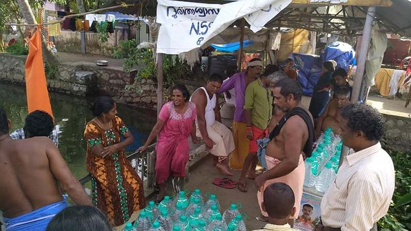
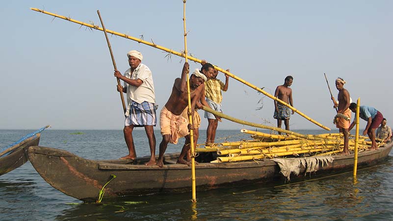
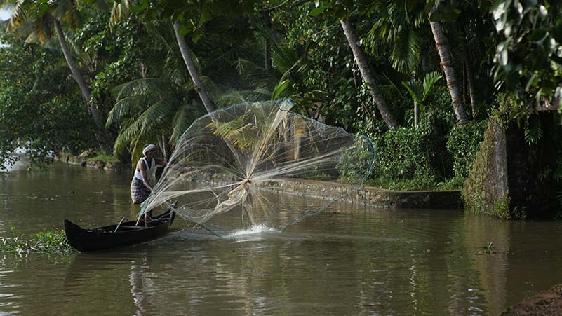
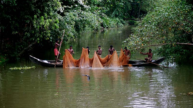
Alappuzha, formerly known as Alleppey district, is the smallest district in Kerala and is one of three districts within the Kuttanad region. Kuttanad covers an area of 110,000 hectares, with 5,000 hectares remaining submerged for most of the year. The region has the lowest altitude in India and is one of the few places where farming is carried out below mean sea level. Biobunds made of mud, coir, banana waste, and bamboo serve as barriers against seawater intrusion and provide an indigenous de-watering and pumping mechanism. Common sources of livelihood in the area include tourism, poultry farming, coir production, fisheries, horticulture, and livestock management. However, the livelihoods of communities dependent on natural resources are being jeopardised by climate change, along with the pressure from tourism.

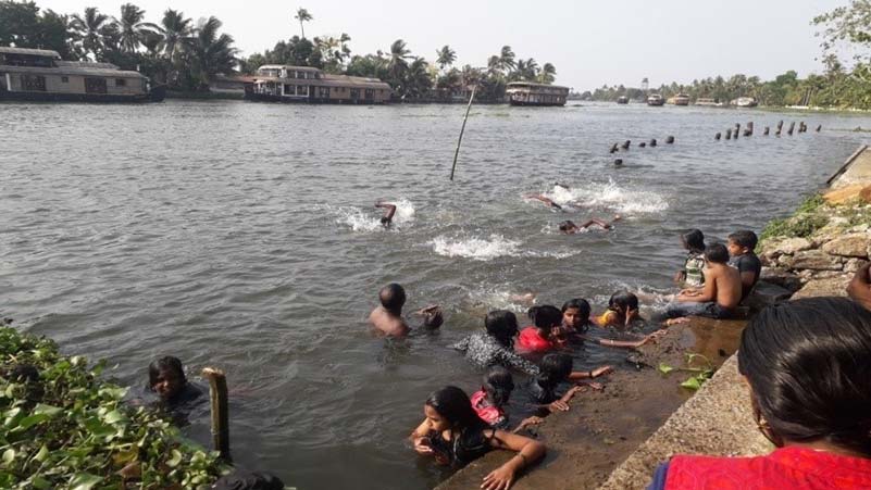
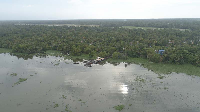
The Kuttanad region (a region covering the Alappuzha, Kottayam and Pathanamthitta Districts, in the state of Kerala) has witnessed changing rainfall patterns, including unseasonal and unpredictable rainfall, as well as stronger and/or more frequent storms. These changes can be attributed to shifts in geo-climatic conditions over the Arabian Sea, resulting in warmer seas and air temperatures. Consequently, the region has experienced an increase in the occurrence of floods. Given its geographical characteristics, such as being low-lying and surrounded by wetlands, Kuttanad was already vulnerable to seasonal floods during the southwest monsoon season. However, with climate change, the local population faces an ongoing threat of constant flooding.

Alappuzha district, in particular, lies more than two meters below mean sea level (MSL). While the district ranks third in Kerala in terms of per capita income, it has also been identified as highly vulnerable to the effects of climate change. Over the period from 1991 to 2020, the district exhibited a relatively high degree of variability in rainfall (14%). Climate projections for 2021-2050 indicate that Alappuzha will experience the highest variability in rainfall and will be particularly affected by extreme precipitation events.

It is important to note that Alappuzha is situated between Vembanadu Lake and the Arabian Sea. Vembanadu Lake is India’s longest lake and part of the Vembanadu-Kol wetland system, which is internationally recognised as a Ramsar wetland of importance. Wetlands play a crucial role in supporting biodiversity, mitigating climate change by acting as carbon sinks, and aiding climate adaptation by acting as natural buffers against storm surges and excess water. However, data shows that the Vembanadu-Kol wetlands have been shrinking due to pollution, unauthorised construction, uncontrolled mining of the lake bed, and other factors. This further exacerbates Alappuzha’s vulnerability to future flooding events. It is evident that climate change is expected to increase the magnitude and frequency of floods, with Alappuzha district and the Kuttanad region projected to be among the worst affected. Therefore, it is crucial to effectively prepare for and respond to future climate-induced disasters to mitigate their environmental and socio-economic impacts.

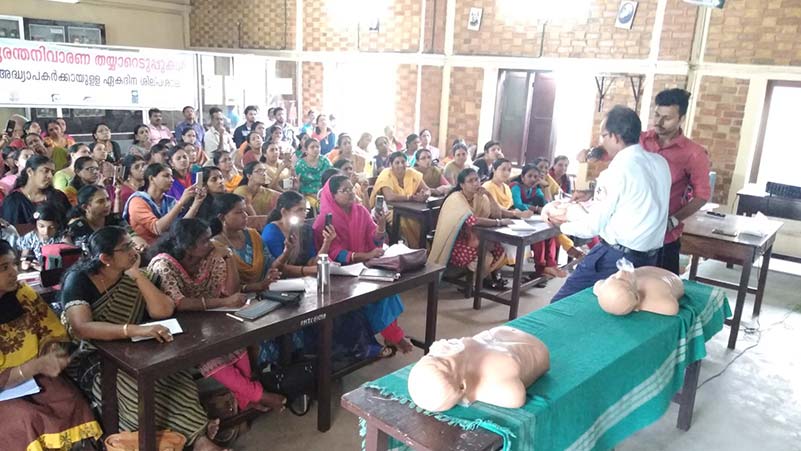
To address this vulnerability, ATREE’s project aims to establish ward-based Disaster Preparedness Gram Sabhas (DPGS) in select gram panchayats in the Kuttanad region. The project aims to train communities to identify and address disaster risks while equipping them with the necessary tools and resources to prevent or minimise the effects of future disasters. The Gram Sabhas, as the lowest level of local self-governance, will serve as the institutional governance system for creating disaster-literate communities and preparing people to respond quickly and effectively to disasters. ATREE plans to implement the DPGS project in flood-prone panchayats of Alappuzha (Kuttanad) and potentially Ernakulam and Kollam districts. The project will involve the support of ASHA and Aardram workers, Kudumbashrees (women-led self-help groups), Disaster Management Teams (DMT), Rapid Response Teams (RRT), as well as collaboration with various levels of Panchayats, state and district disaster management authorities, and other relevant line departments. By implementing the project through Gram Sabhas, the entire population of the panchayats will directly benefit, thereby reducing socio-cultural and economic losses from disasters.

Goals and objectives 

Implemented by ATREE, the project aims to mobilise community members in the most flood-prone wards of Nedumudi and Kainakary Gram Panchayats in Alappuzha district. The goal is to provide them with training, knowledge, and tools to effectively identify, prepare for, and respond to disasters, thereby mitigating climate-induced disasters’ negative environmental and socio-economic impacts. The project has specific objectives, which include:

  1. Facilitating collaboration and partnerships between local self-government bodies (Gram Sabhas), district disaster management authorities, state governments, and other relevant line departments to plan and implement disaster preparedness measures jointly.
  2. Working closely with community organisations, including the three tiers of Kudumbashree, ASHA, and Aardram workers, to mobilise, educate, and train communities about disaster risks and provide support during disasters.
  3. Establishing community-led disaster management teams (DMT) and rapid response teams (RRT) at the ward level to coordinate emergency responses and ensure the well-being of those impacted by disasters. The DMT will lead the planning, while the RRT will lead the implementation.
  4. Installing relevant early warning systems and distributing safety equipment such as first-aid kits, life jackets, and boats to community members.

The project aims to improve the understanding of disaster risks faced by communities, promote disaster risk reduction, enhance disaster preparedness, response, and recovery practices, and ultimately increase human security, well-being, and quality of life.

About the organisation

Ashoka Trust for Research in Ecology and the Environment (ATREE) is a non-profit organisation which generates interdisciplinary knowledge to inform policy and practice towards conservation and sustainability. For over two decades, ATREE has worked on social-environmental issues at local policy levels. ATREE envisions a society committed to environmental conservation and sustainable and socially just development. ATREE’s mission is to generate rigorous interdisciplinary knowledge for achieving environmental conservation and sustainable development in a socially just manner, to enable the use of this knowledge by policy makers and society, and to train the next generation of scholars and leaders. To deliver on this mission, they work across issues like biodiversity and conservation, climate change mitigation and development, land and water resources, forests and governance and ecosystem services and human well-being.