AI-based disaster risk management for cities
- Proposed areas of implementation
- Potential areas of implementation
Climate change is causing an increase in the frequency and severity of extreme events like heatwaves, floods, and droughts. These events pose significant threats to human life, natural landscapes, crops, and both urban and rural infrastructure. Unfortunately, many communities residing in disaster-prone areas lack access to information about such occurrences, making it difficult for them to gauge the exact level of impending risk from standard warnings. This limitation hampers their ability to take proactive action.
To address this issue, Sustainable Environment and Ecological Development Society (SEEDS), in collaboration with Microsoft and technology partner Gramener, has developed a unique artificial intelligence-based risk assessment solution. This solution generates hyper-local risk information on climate-related disasters, such as floods, droughts, cyclones, and non-climatic disasters like earthquakes, that can be used as early warnings for impending disasters. By utilising high-resolution satellite imagery and open-source datasets, the system identifies regions that are socio-economically vulnerable to generate targeted advisories to these communities to avoid immediate losses and recommend actions to provide pre-emptive refuge to people. Additionally, the solution recommends pre-emptive refuge options for people in need.
The primary objective of this project is to support governments, disaster response authorities, and frontline aid organisations in formulating risk-averse strategies to tackle the exacerbating climate emergencies and disasters. The proposed project will continue to work in geographies focused on in the previous phases including parts of Maharashtra, Odisha and Delhi, and the AI-based solution will be introduced into a new geography in Uttarakhand.
Context
Climate-related disasters
India is currently grappling with the severe consequences of anthropogenic climate change, resulting in a surge in extreme events that significantly impact the lives and livelihoods of millions. The country faces a range of climate-related disasters, including floods, droughts, cyclones, and glacial lake outburst floods (GLOFs). With over 74% of districts identified as hydro-meteorological disaster hotspots, India’s vulnerability to these events is evident.
The IPCC’s Sixth Assessment Report (AR6) indicates a decrease in monsoon precipitation intensity and frequency since the mid-twentieth century, leading to an increase in droughts. Since 1997, the drought-prone area in India has grown by 57%, and approximately one-third of districts have experienced more than four droughts in the past decade. Research also suggests that even under the lowest emission scenario, heatwaves are projected to increase from an average of three days in the current climate (1981-2010) to 11 days by the end of the twenty-first century (2071-2100). In the highest emissions scenario, the length of heatwaves could potentially reach 33 days by the end of the century. Rising temperatures also contribute to an increase in frequency of intense rain spells and flood events. India has witnessed a more than 20% increase in heavy precipitation events since 1950. Furthermore, the Himalayan region is expected to experience a temperature rise of up to 2.6 °C, elevating the risk of flood events, including GLOFs, and posing threats of large-scale landslides and agricultural losses.
Additionally, addressing and mitigating climatic risks are vital for India’s growth and economic development. India is estimated to have suffered an average annual loss of about 87 billion dollars from extreme weather events such as tropical cyclones, floods and droughts. Vulnerable communities with limited adaptive capacities bear the disproportionate impact of such risks, jeopardising the achievement of various Sustainable Development Goals (SDGs) related to poverty, hunger, malnutrition, gender, water, and sanitation, among others.
Non-climate-related disasters
It is crucial to address non-climate related disasters, such as earthquakes, with equal importance. In the past 15 years alone, India has witnessed 10 major earthquakes, causing over 20,000 fatalities. The current seismic zone classification reveals that 59% of India’s land is exposed to moderate to severe seismic hazards. Notably, regions like the entire Himalayan belt and the National Capital Territory (NCT) face the risk of extremely severe and high-intensity earthquakes, respectively.
Through discussions with government departments at the city level, SEEDS recognised the necessity of adopting a comprehensive approach to tackle this issue and acknowledged the presence of non-climatic risks that can significantly impact people’s lives. In particular, the proposed project geographies, viz., Delhi, Nagpur, and Pune (Maharashtra), Puri (Odisha) and Dehradun (Uttarakhand), face the following risks from extreme events:
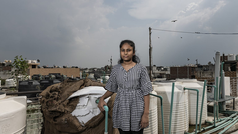
With nearly half of Delhi’s population living in low-income settlements and highly vulnerable to extreme heat, heatwaves have devastating consequences on socio-economic and health outcomes. In East Delhi, where SEEDS has been working, many low-income communities are exposed to extreme summer heat as most earn their livelihoods from outdoor activities. Unfortunately, such communities lack the awareness and capacity to afford cooling devices, making it difficult for them to prioritise heat as a major threat, thus leaving them more vulnerable. Moreover, the Yamuna River binds East Delhi, and several low-income communities residing on the river’s floodplains are often displaced due to flooding caused by extreme rainfall events.
Delhi, situated in a seismically active zone along the Aravalli fault line and neighboring the Himalayas as part of the Indo-Gangetic plain, is prone to seismic activity. Over 30 earthquakes were recorded in Delhi-NCR between April and August 2020, with over 15 originating in the past year.
Preparedness is crucial for earthquakes, particularly in densely populated areas of Delhi where evacuation can be challenging due to overcrowding. Implementing measures such as building codes, structural assessments, and raising awareness about earthquake safety is essential, despite the region’s relatively low frequency of earthquakes.
Research indicate that India’s coastal belts have experienced a 2.5 mm rise in sea level since 1950, leading to increased instances of floods and tropical cyclones; in particular, the city of Mumbai is one of the top 10 districts in India vulnerable to these events.
Dharavi, Oshiwara, Mankhurd, and Sakinaka. These areas are densely populated and home to low-income communities, including daily wage workers, domestic workers, rag pickers, and fisherfolk. Unfortunately, these settlements are highly susceptible to flooding and waterlogging during the monsoon season.
Similar to Mumbai, Puri district is also coastal and ranks among India’s top 10 vulnerable districts to floods and cyclones. Since 2000, Puri district has experienced a four-fold increase in the occurrence of extreme floods and a three-fold increase in extreme cyclones. The area of interest in Puri is Penthakata, home to a local fisherfolk community that mostly consists of migrants from neighbouring Andhra Pradesh.
Maharashtra features in the top 5 states with maximum exposure to drought events due to rising temperatures and their compounded effects. In particular, Nagpur is a hotspot district highly sensitive to extreme drought events. The major drivers are micro-climatic changes led by anomalies in land-surface temperature and precipitation. Additionally, Nagpur is part of the Vidarbha region in Maharashtra, one of India’s hottest regions, and faces intense heatwaves every year.
Uttarakhand is prone to various hazards such as droughts, flash floods, landslides, cloudbursts, and forest fires. Dehradun, situated in the foothills of the Doon Valley, occupies both flat and hilly terrain. Climate sensitivity studies highlight its high vulnerability to extreme heat (heatwaves) and moderate vulnerability to river floods, urban floods, and landslides. Additionally, Dehradun falls under the second highest earthquake risk category in India.
Problem statement
While India has been working on strengthening end-to-end early warning systems (EWS) for all hydro-meteorological hazards, particularly in the context of their increased threat due to climate change, disasters continue to batter the country. This ongoing challenge urges key stakeholders such as the government, private sector, and civil society organisations to reassess the warning systems’ scope, structure, and effectiveness.
Currently, several challenges exist:
- Greater technological enhancement is needed for the EWS to robustly cover a range of meteorological events such as heatwaves, floods, and thunderstorms and identify risks from localised events such as cloudbursts. While the technology can provide current risk information at a macro level, it is difficult to customise it to the local level. If hyper-local information is provided, it relies on time-consuming and cost-intensive field surveying methods.
- At the institutional level, immediate response and long-term planning efforts are impeded by a need for updated district-level disaster management plans and their integration into EWS data. Additionally, urban local body (ULBs) officials lack the technical capacity to understand disaster risk reduction (DRR), risk assessment, and EWS.
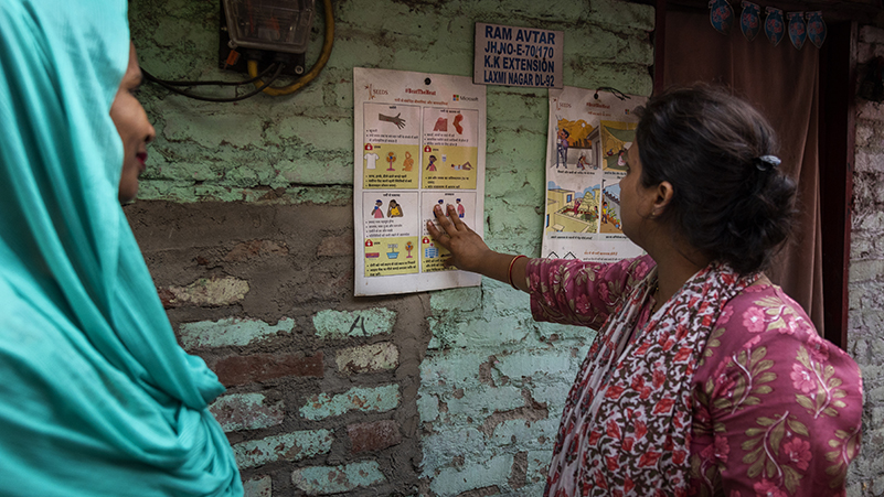
- At the community level, there is a lack of impact-based forecasts, which can help populations decipher the precise extent of the impending risk from the standard warnings received. Additionally, dissemination of information in a timely, lucid manner in local languages using channels based on user needs (such as mobile phones, radio, community announcements) is needed. These activities, combined, make informed pre-emptive action by individuals/local communities more widespread.
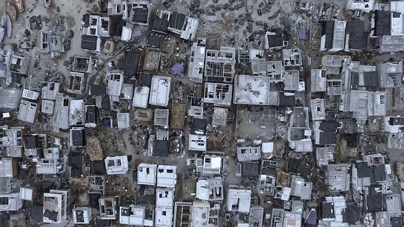
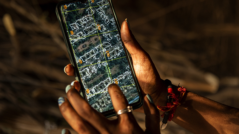
Artificial intelligence (AI) helps address these gaps, making warnings hyper-local, and reducing the unit area under warnings from many square kilometres to clusters and individual buildings. It can also process data in real-time, significantly expediting the formulation and dissemination of warnings. Thus, AI is a crucial solution to improve the efficiency and effectiveness of disaster management processes overall, and risk assessment and early warning.
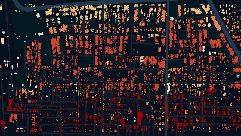
SEEDS, in partnership with Microsoft and Gramener, has developed the Sunny Lives AI model, which uses satellite imagery, AI, machine learning, and advanced analytics to automate the process of identifying vulnerable communities to build more effective disaster vulnerability assessment systems. The model provides hyper-local, household-level risk information on extreme climate events (floods, droughts, cyclones) and non-climate disasters (earthquakes). The output from the model is translated into simple, widely understandable information and advisories that can be used by communities, governments, disaster response teams and frontline organisations for immediate response, pre-emptive action, and long-term planning for risk reduction.
SEEDS’ technical expertise in using a multi-hazard AI tool is coupled with initiatives to spread community awareness and mobilising of ground partners. To develop their framework, SEEDS also draws on a pool of urban planners and disaster experts who can play an important role in long-term resilience planning.
Goals and objectives
The project aims to improve the efficiency and precision of the Sunny Lives AI model and its implementation in addressing climate-induced and non-climatic disasters. Its main objective is to deliver hyper-local, timely, relevant, and easily understandable risk information in local languages to communities that are vulnerable to these disasters.
Specific objectives of the initiative include:
- To improve the risk awareness of communities in the Areas of Interest (AoI);
- To enhance the preparedness of communities in terms of pre-emptive action;
- To strengthen the partnership network among communities, government, and aid agencies, and
- To skill community-based mobilisers and volunteers.
About the organisation
SEEDS (Sustainable Environment and Ecological Development Society) is a not-for-profit organisation that enables every Indian’s right to a life of dignity, secure from disasters. It builds community resilience through practical solutions in the areas of disaster readiness, response and rehabilitation empowering the most vulnerable across Asia to build a better future. Since 1994, the organisation has worked extensively on every major disaster in the Indian subcontinent – grafting innovative technology on to traditional wisdom. It has reached out to families affected by disasters and climate stresses; strengthened and rebuilt schools and homes; and has invariably put its faith in skill-building, planning and communications to foster long-term resilience.
SEEDS is also India’s first agency to be verified on the parameters of the global Core Humanitarian Standards (CHS) – an international certification system for quality and accountability in humanitarian response. SEEDS has been awarded with the 2022 United Nations Sasakawa Award for Disaster Risk Reduction by the United Nations Office for Disaster Risk Reduction (UNDRR) and the Subhash Chandra Bose Aapda Prabandhan 2021 by the Government of India acknowledging the invaluable contribution and selfless service rendered in India in the field of Disaster Management.


